The Indiana DNR has been conducting weekly waterfowl inventories on many Fish & Wildlife Areas, Reservoirs, State Parks, and National Wildlife Refuges since 1986. Before 2012, these surveys all focused on “still water” areas, such as marshes and lakes. No river segments were surveyed. Since these survey data are mostly used in setting waterfowl hunting season dates, the lack of river data made it difficult to account for the needs of river hunters during that process.
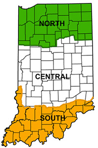
In 2012, the DNR started flying winter (November-January) waterfowl surveys over the lower Wabash River. A segment of the West Fork White River was added in 2013. These surveys added important data regarding how waterfowl use rivers in the South and Central waterfowl hunting zones. This information has better allowed the DNR to account for hunters who use rivers in southern Indiana when setting waterfowl hunting seasons.
Analyses performed after 8 years of surveys clearly show that duck usage of the lower Wabash consistently peaks during the last 2-3 weeks of January. Duck usage on the West Fork White is more variable, but within the range seen on Fish & Wildlife Areas in the Central Zone. Because these results are consistent across several years, the surveys are no longer necessary to determine when ducks use these river systems. If evidence is seen in future years of shifts in migration timing, the surveys could be revisited. When the final report on these surveys is finished, it will be posted here.

