Cecil M. Harden Lake (Raccoon SRA) advisories
- The Indiana Department of Natural Resources has adjusted services, events and operations to protect Hoosiers and prevent further spread of COVID-19. Please visit on.IN.gov/dnrcovid19 for a listing of what is open, closed, restricted and canceled.
- Blue-Green Algae: Found in lakes year-round. More information.
- Description
Includes the Raccoon State Recreation Area and Historic Mansfield Roller Mill.
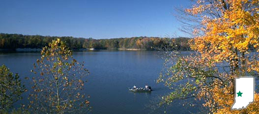
Native forest and large rock outcrops line the upper part of Big Raccoon Creek. Cecil M. Harden Lake resulted from the damming of the creek for flood control. The lake also provides recreation, wildlife management and economic benefits. A variety of fish, flora and fauna can be viewed at the property.
Nearby Historic Mansfield Roller Mill is a preserved, working example of industrialization in Indiana at the turn of the 20th century. This 1880s flour mill uses machinery from that time to show visitors how flour and cornmeal were processed from wheat and corn. It is an almost complete and unchanged example of flour mills from this time period.
Water safety matters! If you use one of our big reservoirs for swimming, fishing, boating or skiing, check out Bobber the Water Dog, brought to you by the U.S. Army Corps of Engineers.
- Activities
- 1880's Roller Mill (view audio slideshow)
- Tours and Corn Grinding Demonstrations
- Archery Range
- Basketball Courts
- Boating / 5 Launch Ramps
- Fishing / Ice Fishing
- Fishing Pier (open when water level permits)
- Hiking Trails
- Horseshoe Pits
- Hunting / Limited
- Interpretive Services
- Picnicking / Shelterhouses
- Playground Equipment
- Rental - Fishing Boats, Pontoons
- Swimming / Beach (Policy)
- Volleyball Courts
- Waterskiing
- Wildlife Viewing Areas
Camping - See campground maps under MAPS tab
- Electric / 240 sites
- Non-electric / 37 sites
- Primitive / 35 sites
- Youth Tent Areas
- Camp Store
- Dumping Station
INFORMATION
- 1880's Roller Mill (view audio slideshow)
- Trails
Note: For trail locations, view the property map under the MAPS tab.
1. MODERATE (1.5 miles)—Starts at the main boat ramp and goes around the south shore of the peninsula to the Payne shelter, past the 1800s Payne Cemetery, Miami Vista, She-Qui-Oh Vista (“Lean Raccoon”) and three scenic overlooks of the lake. The trail returns hikers to near the campground store.
2. EASY (0.8 miles)—ADA Paved Bike Trail—Starts just north of the campground store. Bikers and hikers will see areas of second growth, mature forest and steep ravines before reaching the Hilltop Shelter parking lot.
3. MODERATE (1.1 miles)—Starts on the northern edge of Raccoon Run campground. Trees include maple, oak, poplar and sycamore. Hikers will pass several bank-fishing areas before the trail concludes at the fish-cleaning station.
4. RUGGED (2.1 miles)—Starts near the west edge of the Whitetail campground. Hikers will see deep sandstone cliffs and several open views of the lake while on the rugged terrain.
5. MODERATE (1.4 miles)—Starts near the Bluebird shelter, leads through successional vegetation, second-growth timber and a variety of artificial wildlife homes. Trail loops and returns to shelter.
6. ARCHERY TRAIL—Trail begins at the gatehouse parking lot and leads through the Twin Ponds area. Archery enthusiasts can shoot at stationary targets and from elevated stands along a five-station, real-condition, simulated practice trail.
*Trails 1-5 closed during high water.
PLEASE STAY ON MARKED TRAILS.
- Maps