Turkey Run State Park advisories
- The Indiana Department of Natural Resources has adjusted services, events and operations to protect Hoosiers and prevent further spread of COVID-19. Please visit on.IN.gov/dnrcovid19 for a listing of what is open, closed, restricted and canceled.
- Description
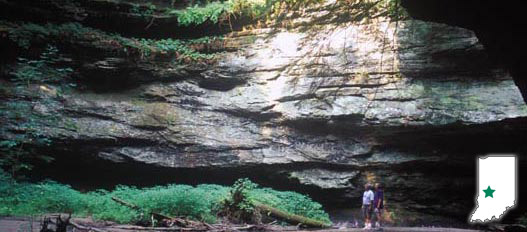
You'll marvel at the natural geologic wonders of this beautiful park as you hike along its famous trails. Nestled along State Road 47 southwest of Crawfordsville, the park offers the chance to explore deep, sandstone ravines, walk along stands of aged forests, and enjoy the scenic views along Sugar Creek.
Make sure to visit the Colonel Richard Lieber Cabin, which commemorates the contributions of the father of Indiana's state park system.
During the summer, pool hours may change because of weather and staffing. Please contact the property office for exact times before your visit.
- Activities
- Picnic areas w/shelters
(Shelter Reservations) - Interpretive Naturalist Services
- Nature Center / Planetarium
- Cabins, Inn Operated
- Rental - Cultural Arts Programs
- Fishing
- Hiking Trails
- 5 Mile Hiking Challenge
- Turkey Run Inn Accommodations
w / Indoor Pool
toll free 1-877-500-6151 - Inn Restaurant
- Meeting & Conference Facilities
- Playgrounds
- Saddle Barn with escorted rides (765) 597-2280
- Tennis & Other Games
- Swimming / Pool (Policy) Contact office for hours.
Camping - See campground maps under MAPS tab
- Electric / 213 sites
- Youth Tent Areas
- Camp Store
- Dumping Station
INFORMATION
- Picnic areas w/shelters
- Description of Hiking Trails
Note: For trail locations, view the property map under the MAPS tab.
All trails have portions that use ravine streambeds as trail surface, so some sections can become slick and trail tread uneven. Parts of these trails may be impassable during high water and should be considered closed during such times and alternate trails used.
*The ladders used on this trail can be hazardous for visitors with some medical conditions or disabilities. Hikers with small children and pets should use alternate trails.
1. MODERATE/RUGGED (3 miles)—The big-tree trail. Fine sycamores and several huge black walnut trees; covered bridge. Portions may be impassable during high water.
2. RUGGED (1 mile)—Follows under cliff edges. A trail for the more adventurous. Be careful.
*3. VERY RUGGED (1.7 miles)—The ladders trail. Unusual hiking between the steep walls of both Rocky and Bear hollows. Be careful. Portions may be impassable during high water.
4. MODERATE/RUGGED (2 miles)—Follows a fine little valley to the Lusk home, past the old quarry and coal mine. Portions may be impassable during high water.
5. MODERATE (.7 mile)—Fine trees; 140 steps (going down is from the west.)
6. MODERATE/RUGGED (.5 mile)—Short hike through a deep canyon. Trail meanders across a stream on steppingstones. May be impassable during high water.
7. MODERATE (.7 mile)—Virgin wood, hemlock trees. Portions may be impassable during high water.
8. MODERATE (1.5 miles)—Peaceful trail with moderate hiking that follows a small creek.
9. VERY RUGGED (1 mile)—The best trail to see virgin wood is also the most rugged. Be careful.
10.MODERATE (1.4 miles)—To “Camel’s Back;” fine scenic view. Many unusual formations due to erosion.
11.EASY (.5 mile)—A short hike high above Turkey Run Hollow to the Lieber Memorial and Log Church.
PLEASE STAY ON MARKED TRAILS.
- Maps