Header

Main Content

Article

Chain O' Lakes State Park

Chain O'Lakes
2355 E. 75 S.
Albion, IN 46701
260-636-2654
Subscribe to email newsletter
 

Chain O' Lakes State Park advisories

  • The Indiana Department of Natural Resources has adjusted services, events and operations to protect Hoosiers and prevent further spread of COVID-19. Please visit on.IN.gov/dnrcovid19 for a listing of what is open, closed, restricted and canceled.
  • Blue-Green Algae: Found in lakes year-round. More information.

Upcoming at Chain O'Lakes State Park

  • Description

    This property is a stop on the

    Indiana Birding Trail Logo

    Learn more at www.indianabirdingtrail.com.

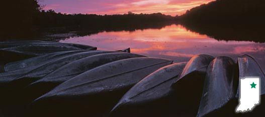
    This is lake country and a small boater’s paradise. Nine connecting lakes will be the center of your adventures at Chain O’Lakes. Paddle through the chain of serene kettle lakes, hike the 23 miles of forested trails, fish the electric-motors-only lakes, stay overnight in a forested hillside family cabin, visit the park’s historic one-room Stanley Schoolhouse, or explore the Nature Center. Other facilities available for visitors to enjoy include a campground, beach and picnic shelters.

    Chain O' Lakes Interpretive Plan

    Stay connected

     
  • Activities
    • Boat Launch Ramps - Long, Dock, Sand, Miller, and Norman Lakes
    • Boating / Elect. motor only
    • Nature Center (open the Saturday before Memorial Day- Labor Day)
    • Interpretive Naturalist Services
    • 9 Lake Challenge
    • Shelters
      (Shelter Reservations)
    • Rental-Canoe, Paddleboat, Kayak and Rowboat. Canoe rental on weekends & holiday by the hour only.
    • Cross-County Skiing / No Ski Rental
    • Fishing / Ice Fishing. Fish cleaning station.
    • Hiking Trails
    • Swimming / Beach - open the Saturday before Memorial Day- Labor Day
    • Historic one-room Stanley Schoolhouse

    Camping - See campground maps under MAPS tab

    • Electric / 331 sites
    • Non-Electric / 49 sites
    • Primitive / 33 sites
    • Rally Camp / 4 sites
    • Canoe Camp / 4 sites
    • Youth Tent Areas / 5 sites
    • Campground Reservations
    • Camp Store
    • Dumping Station

    INFORMATION

  • Trails

    DESCRIPTION OF HIKING TRAILS

    Note: For trail locations, view the property map under the MAPS tab.

    1. MODERATE (1.5 miles)—Begins north of campground, follows a ridge through the woods before dropping down in a valley, crosses two channels as it circles around the north side of Dock Lake, and returns to the campground.

    2. MODERATE (1 mile)—Begins at the parking lot on the north shore of Bowen Lake, drops down and follows the lakeshore through the woods and returns to the parking lot.

    3. EASY (1.3 miles)—Connects campground to the beach and nature center.

    4. MODERATE (1.5 miles)— Passes four lakes, wooded areas, swamps and open fields.

    5. EASY (1.3 miles)—Follows shore around Sand Lake; flat and wooded.

    6. MODERATE (3 miles)—Trail 6 can be accessed from the cabins, campground or Dock Lake boat ramp. Follows the southern shoreline of both Dock and Long lakes, and the channel between the two.

    7. EASY (1.8 miles)—Begins at Sand Lake fishing pier, follows the channel to Bowen Lake, turns west to connect with Weber Lake and returns along the channel to Sand Lake. It winds through lowlands, along two different channels, and through an upland forest.

    8. MODERATE (1.5 miles)—A self-guided nature trail, begins at Stanley Schoolhouse, circles Finster Lake and crosses a glacial kame, and returns to the schoolhouse. Map.

    9. RUGGED (1.3miles)—Starts at the schoolhouse parking area, travels through the Henslow’s sparrow restoration area open field, through a wetland, to the top of wooded glacial hill, and around Kreiger Lake, a beautiful small kettle lake.

    10. MODERATE (2.5 miles)—This trail travels through open rolling hills, making it excellent for cross-country skiing in the winter.

    11. EASY (4 miles)—Connects the Stanley Schoolhouse and Youth Group Tent/Rally campgrounds. This turf-covered trail is excellent for cross-country running or skiing.

    12. MODERATE (3.5 miles)—Begins and ends at beach, travels through glacial topography, hardwood forest, and follows ridgeline of a deep ravine with a meandering stream.

    PLEASE STAY ON MARKED TRAILS.
  • Maps