Main Content
Article
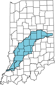
White & West Fork White River Basin
- Download the entire document (10mb)
- Introduction and
Geology chapters (3mb) - Ground-Water Hydrology chapter (3mb)
- Ground-Water Quality,
Glossary, References,
and Appendices chapters (3.8mb)
The document includes 11 plates which are also available for download. Plates 2-9 are in shapefile, .JPG, and .PDF format. Plate 1 is available in .JPG and .PDF format only. The shape can be assembled using ArcExplorer which can be downloaded from ESRI's website .
| Plate number | Adobe Acrobat PDF format | .JPG image file | Shape compressed using PK Zip |
|---|---|---|---|
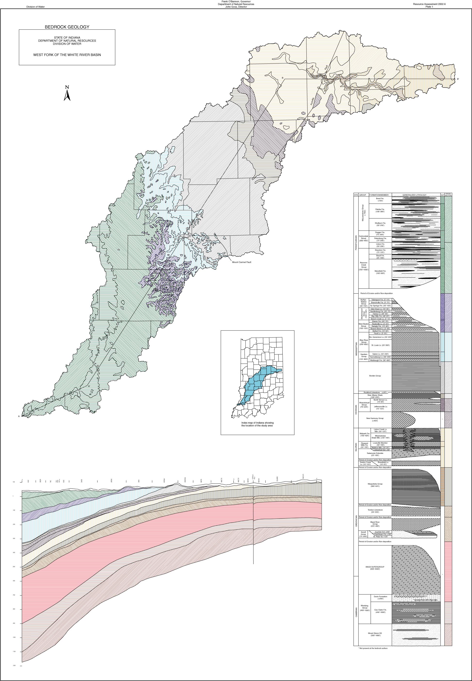
| Plate 1-Bedrock Geology | 1.5mb | 796kb | NA |
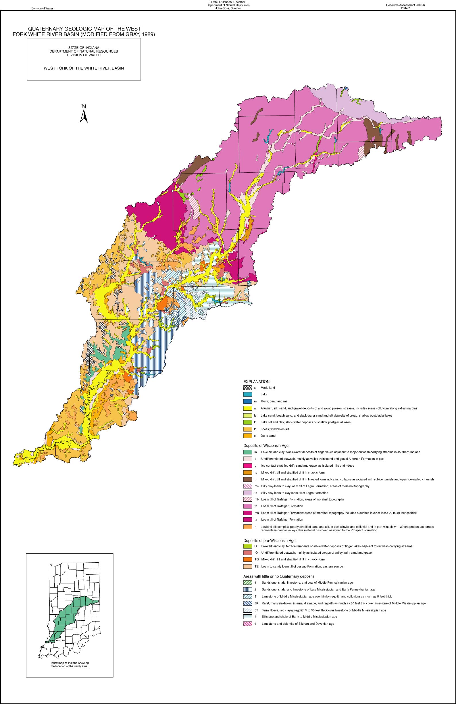
| Plate 2-Quaternary Geologic Map of the West Fork White River Basin | 2.8mb | 376kb | 688kb |
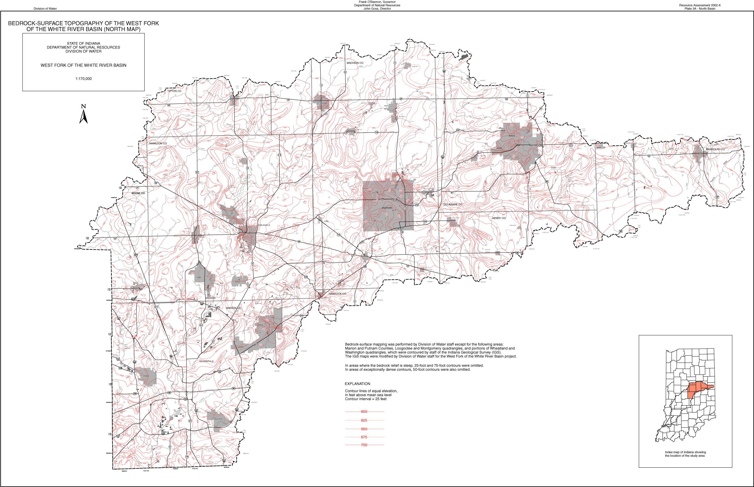
| Plate 3a-Bedrock Surface topography of the West Fork of the White River Basin (North Map) | 1.8mb | 591kb | 1020kb |
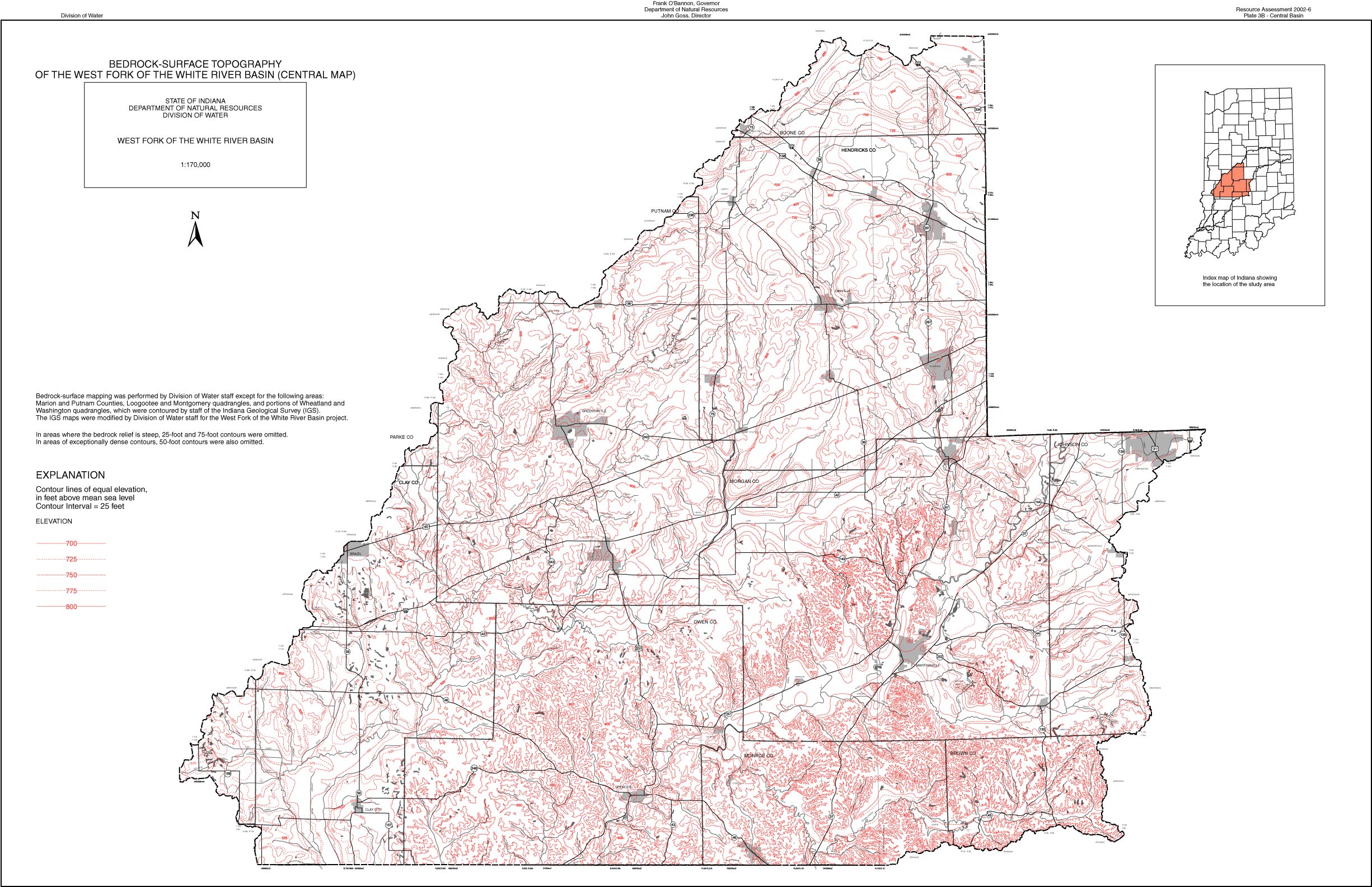
| Plate 3b-Bedrock Surface topography of the West Fork of the White River Basin (Central Map) | 3mb | 782kb | 2.8mb |
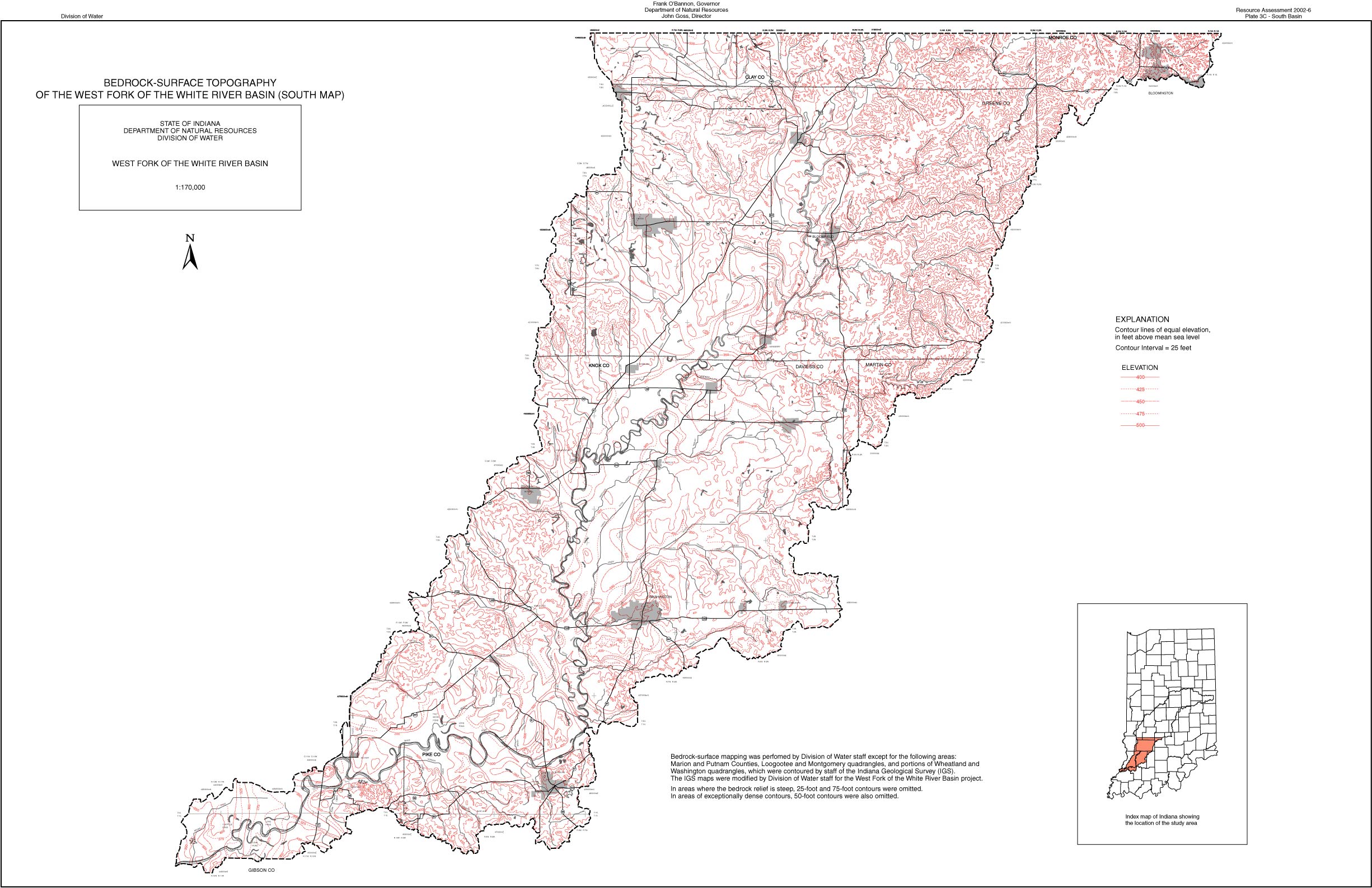
| Plate 3c-Bedrock Surface topography of the West Fork of the White River Basin (South Map) | 2.3mb | 565kb | 2.1mb |
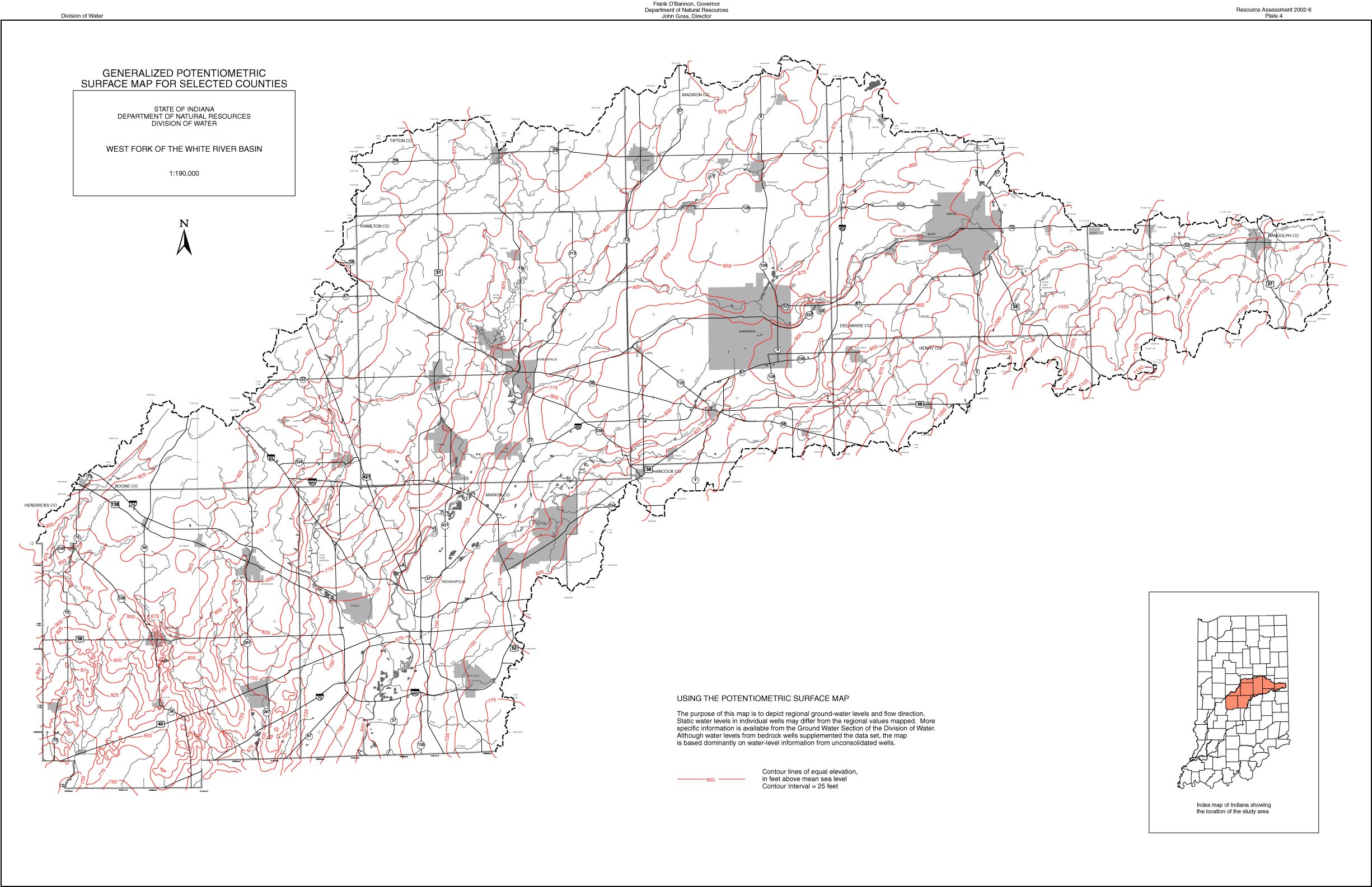
| Plate 4-Generalized Potentiometric Surface Map for Selected Counties | 1.1mb | 550kb | 815kb |
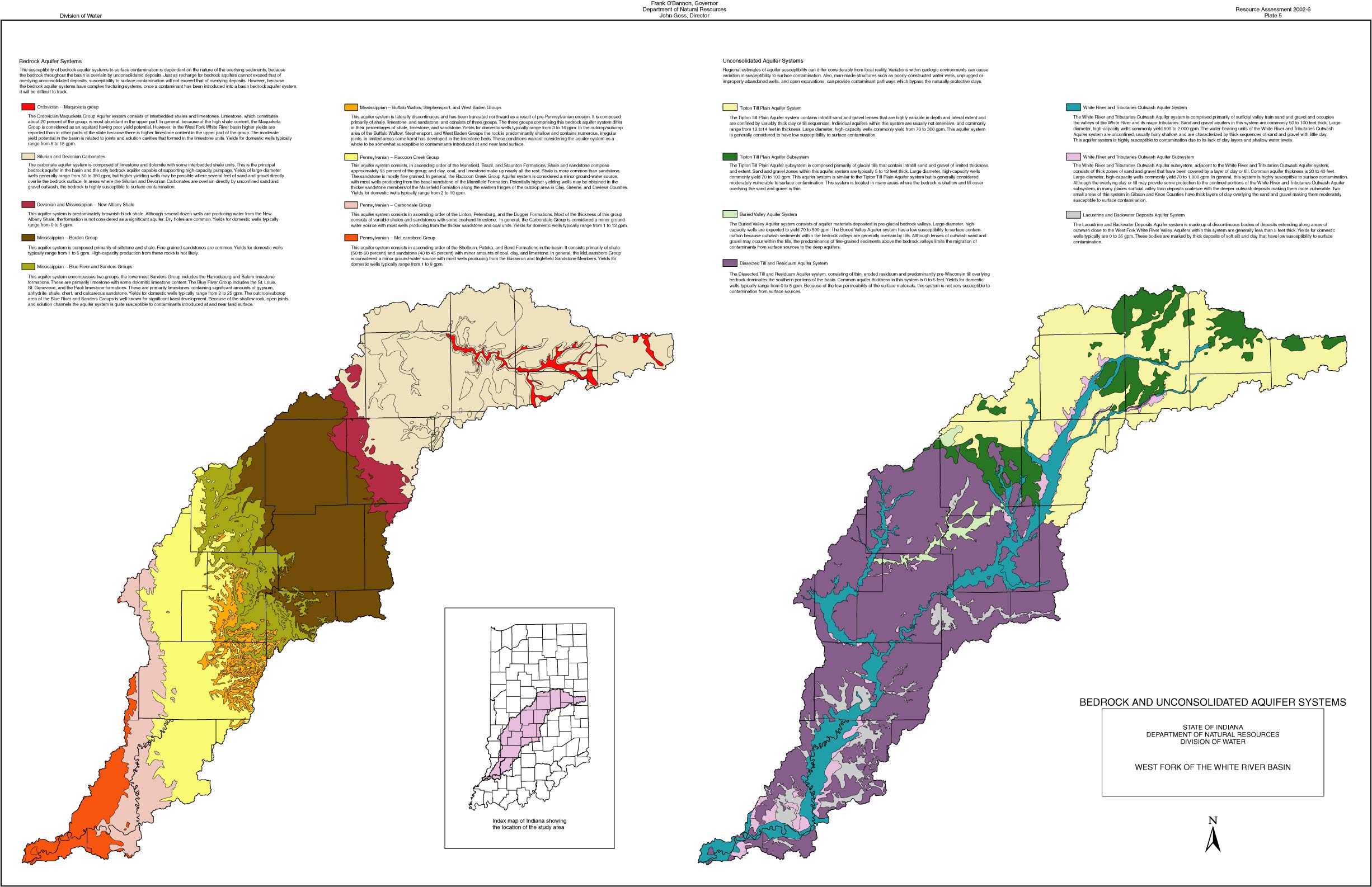
| Plate 5-Bedrock and Unconsolidated Aquifer Systems | 2.2mb | 468kb | 1.2mb |
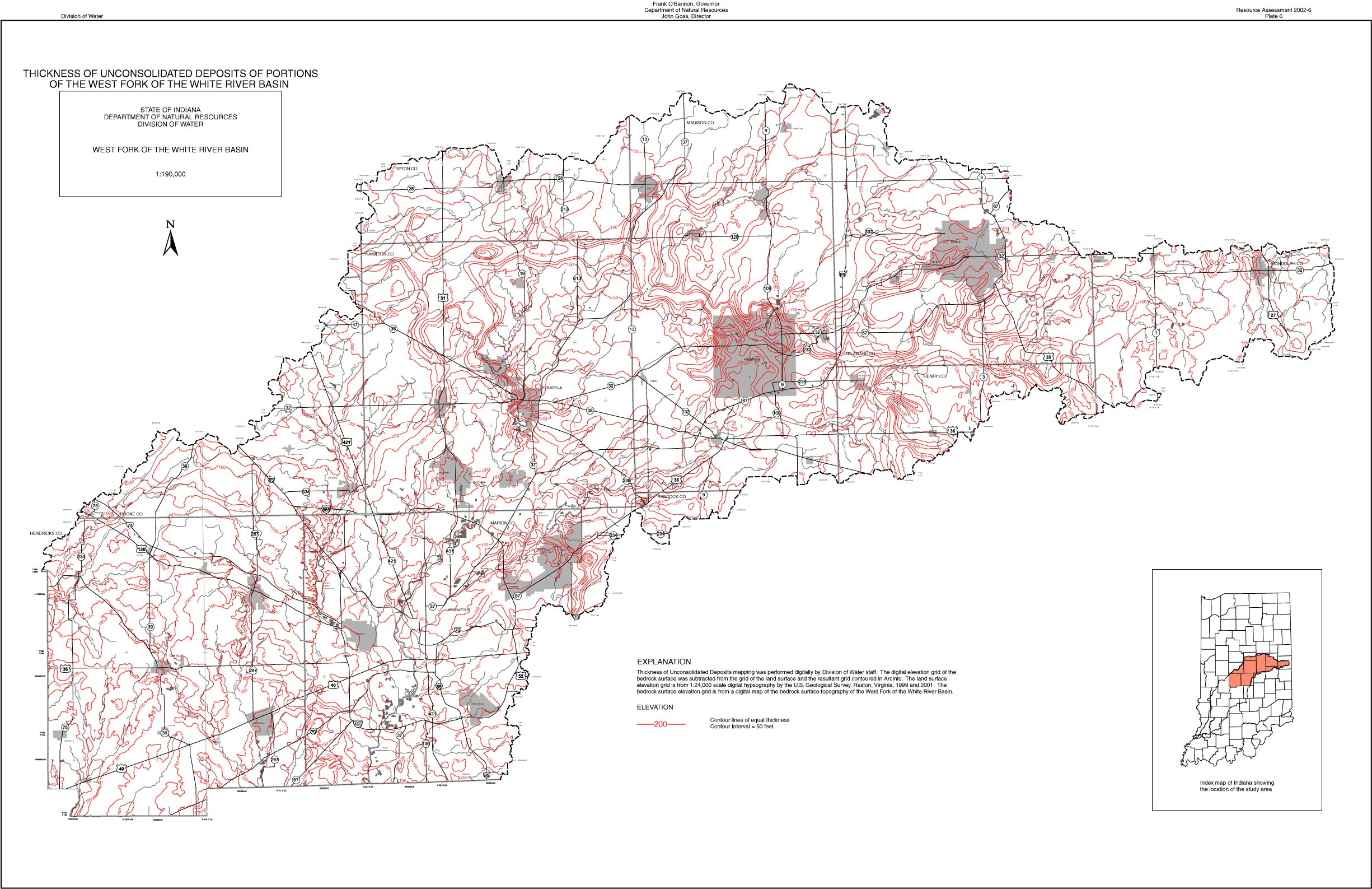
| Plate 6-Thickness of Unconsolidated Deposits of Portions of the West Fork of the White River Basin | 1.5mb | 652kb | 1.2mb |
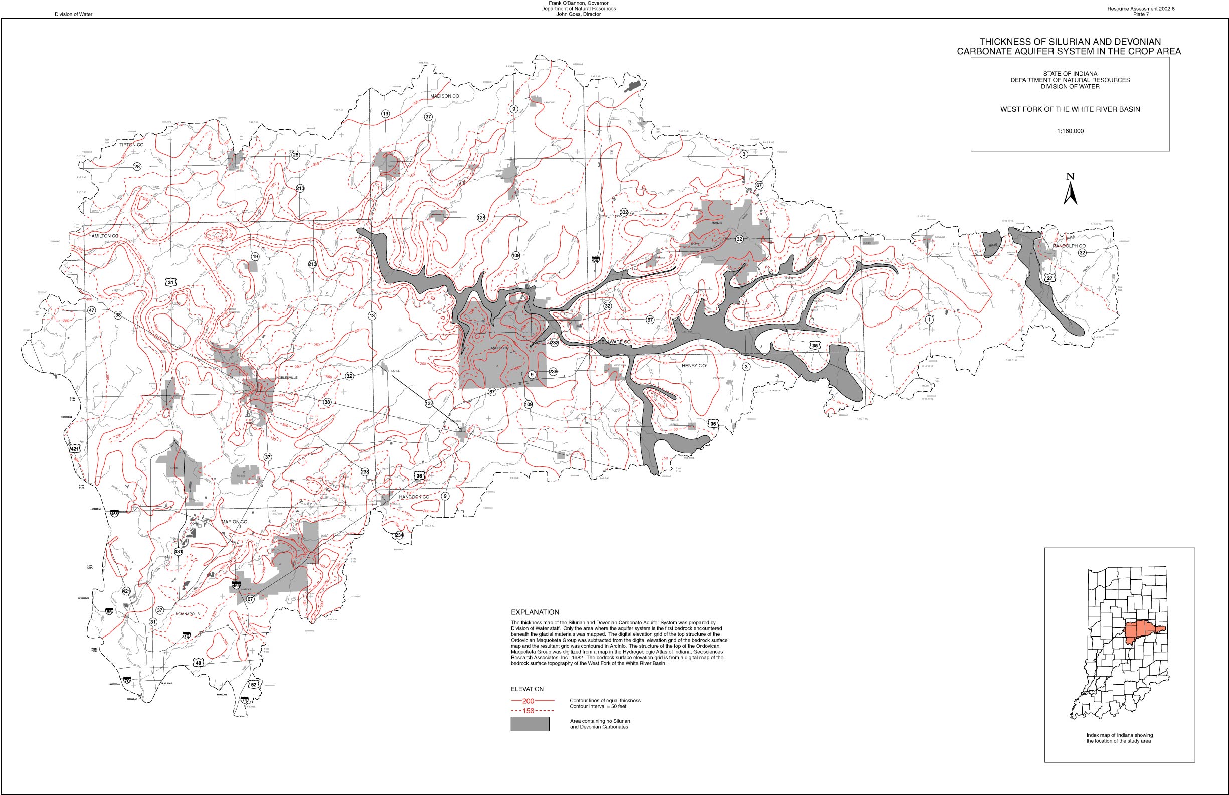
| Plate 7-Thickness of Silurian and Devonian Carbonate Aquifer System in the Crop Area | 1mb | 521kb | 963kb |
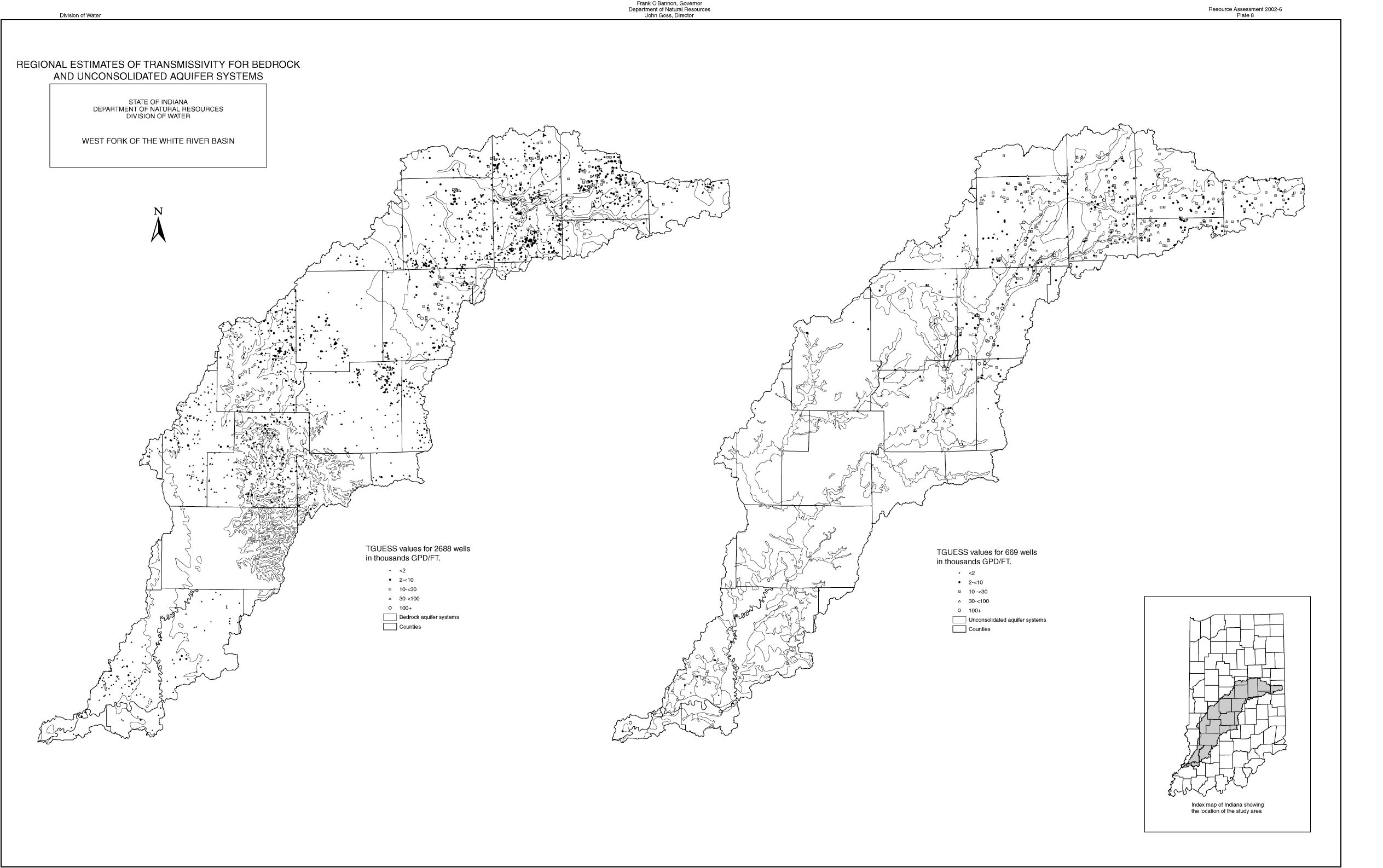
| Plate 8-Regional Estimates of Transmissivity for Bedrock and Unconsolidated Aquifer Systems | 1.1mb | 336kb | 1.3mb |
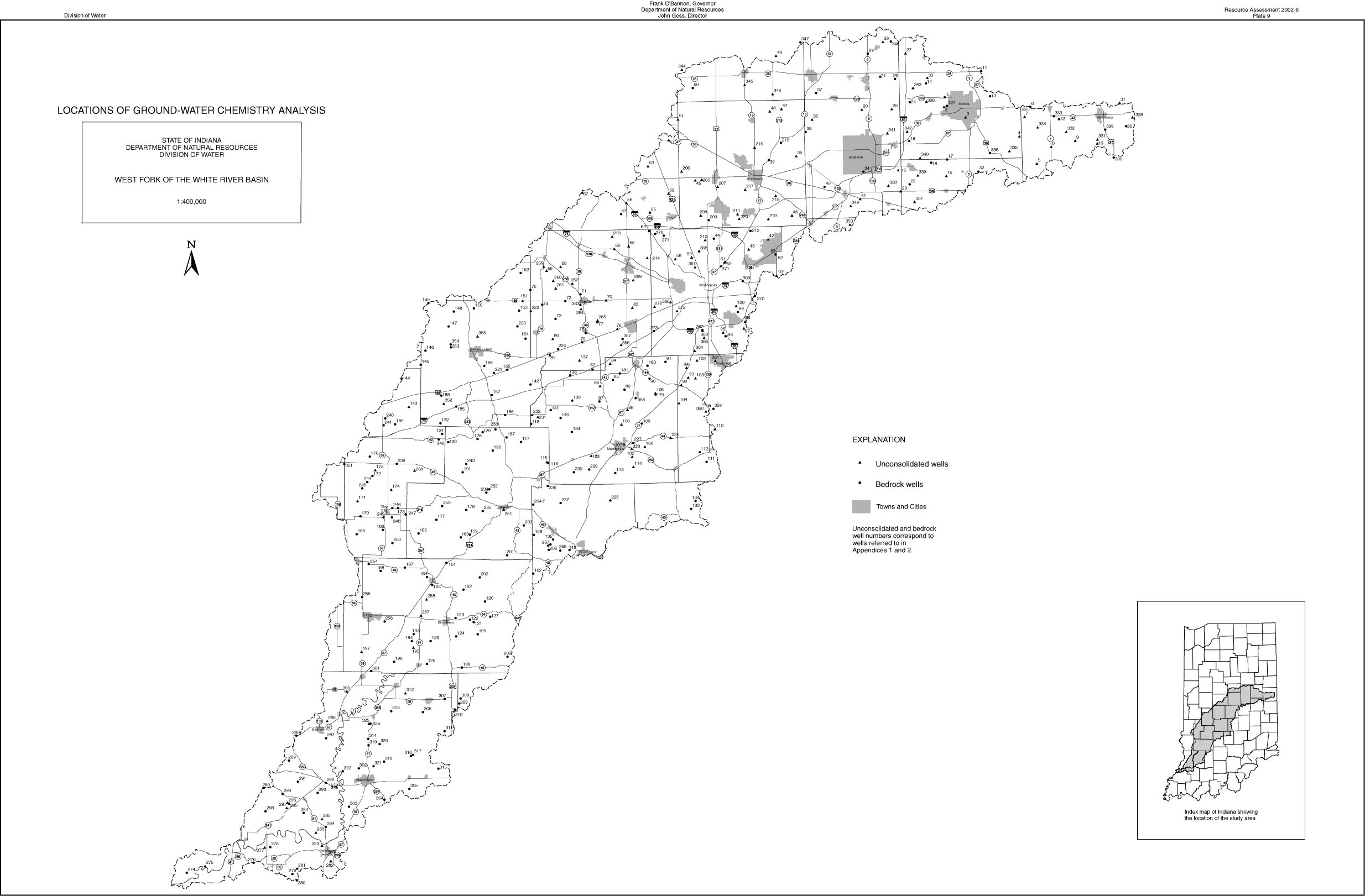
| Plate 9-Locations of Ground-water Chemistry Analysis | 550kb | 260kb | 1.6mb |
