Main Content
Article
Water Resource Assessment 2003-7: Hydrogeology of the Lafayette (Teays) Bedrock Valley System, North-Central Indiana (2003)

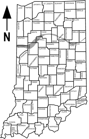
Map showing the location of the Lafayette (Teays) bedrock valley in Indiana.
- Download the entire document (10.6mb .pdf file)
- Introduction, Purpose and Scope, Geography of the Project Area, Physiography, Geologic Setting, Valley Fill Composition and Ground-Water Potential
- Ground-Water Availability
- Generalized Ground Water Availability of the Bedrock Aquifers Underlying the Lafayette (Teays) Bedrock Valley, Ground Water Flow - Potentiometric Surface, Ground Water Quality, Recharge, Conclusions, References Cited, chapters and Appendix A
The document includes 2 plates which are also available for download. Both plates are in shapefile, .JPG, and .PDF format. The shape files can be assembled using ArcExplorer which can be downloaded from ESRI's website .
